

SpotsWhere to surfCampsTrip planner
Log a session
Surf Scout

Where’s the best place to surf? Skill-graded, honestly reviewed, globally indexed.

Explore
  • Camps & map
  • Best-of guides
  • Where to surf
  • Trip planner
  • Surf & work remotely
  • Surfboard airline fees
  • Board Check
  • Flying with a surfboard
  • Surf Fit Score quiz
Regions
  • Portugal
  • Morocco
  • Bali
  • Costa Rica
  • Sri Lanka
About
  • About
  • Trust & reviews policy
  • How we rate
  • Privacy
  • Analytics choice
  • Terms
  • Photo credits
  • Send feedback
© 2026 Surf Scout. Prototype build.We earn no commission on any link on this site.

Point break · A-frame

Mizata

Mizata, La Libertad, El Salvador

Skill: Levels 2-5
SpotsWhere to surfCampsTrip plannerBoard CheckQuiz
Surfed here? Log a surf
  1. Map
  2. ›
  3. El Salvador
  4. ›
  5. Mizata

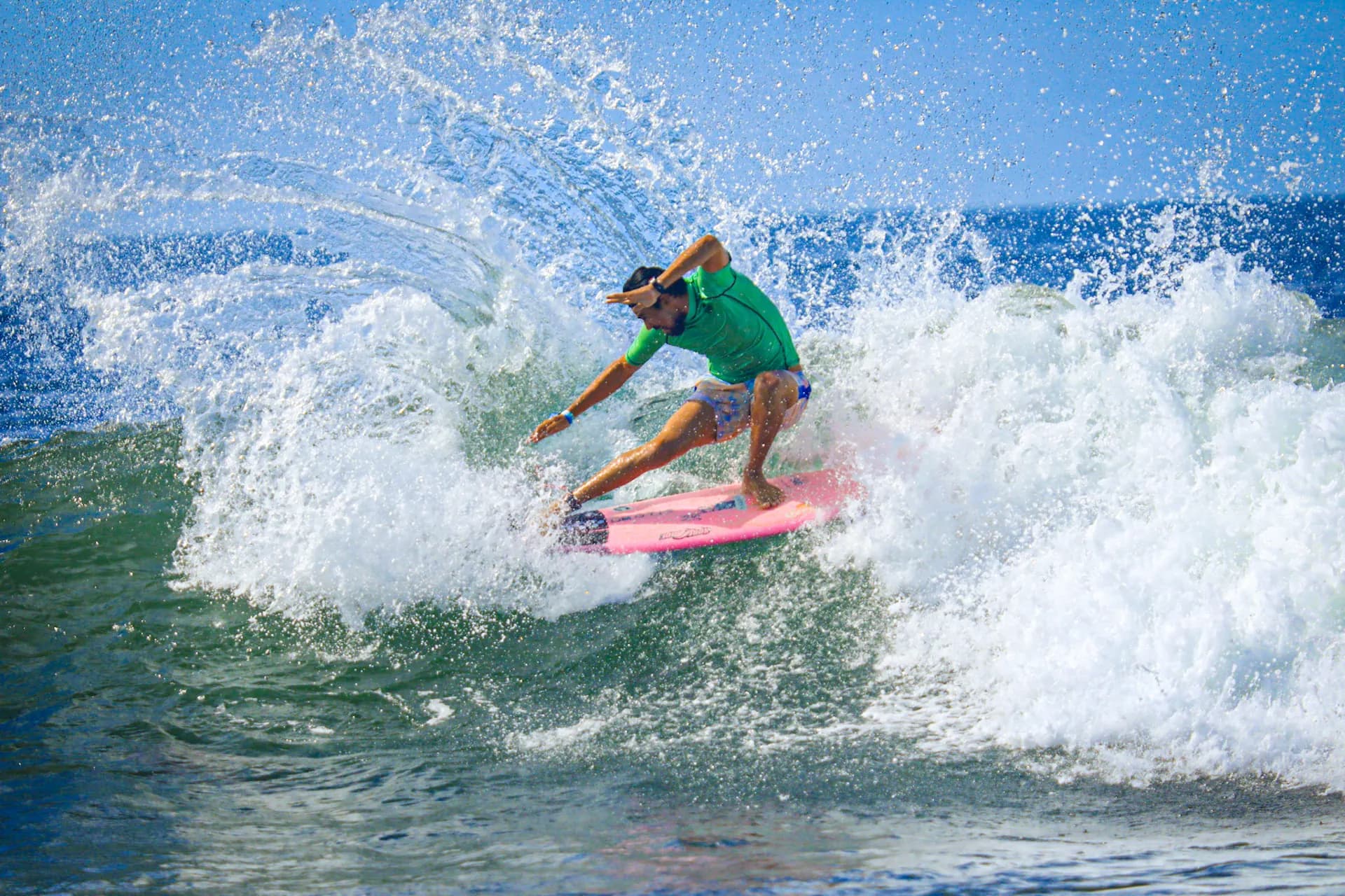
A right-and-left point-and-rivermouth setup over sand with rock that wannasurf calls 'by far the most uncrowded good surfing wave in El Salvador', working close to 150+ days a year and rated for 'All surfers'. Mizata Point Resort sits right on the point; wannasurf's access note lists this as a 4x4-only dirt-road turn off the coastal highway around km 86.

Plan a trip here →

Advanced details

The granular read for surfers who want it.

Wave type
Point break
Bottom
sand+rock
Direction
A-frame
Best swell
SW
Best tide
all

Surf report

Live
2/5

Barely worth it

2 of 2 lined up. Swell and tide suit Mizata right now.

Next good window: 22 Nov 2026, 07:00

Live conditions

10:00 (local)
Wave
1.2m
from SSW
Period? (what does this mean?)Time between waves. Longer period = more powerful, better-organised waves.
11.6s
Swell? (what does this mean?)Waves made by distant storms, smoother and more ordered than the choppy waves a local wind whips up.
1.2m
12s from SSW
Wind? (what does this mean?)Offshore wind (land to sea) holds waves up and smooths their faces; onshore wind (sea to land) makes them crumble and close out sooner.
9km/h
from SE
Estimated wave energy? (what does this mean?)How much power each metre of wave front carries (kW/m), worked out from height and period — higher numbers mean waves that push harder.
~8 kW/m(Small)

Calculated by us from the height and period above, not measured — and it describes the swell offshore, not the wave at the break.

Waves from DWD Global WAM, wind from ECMWF IFS, for a model grid point 17 km from the break. Fetched 16 Nov 2026, 09:00. Times on this card are local to Mizata. Weather data by Open-Meteo.com, licensed CC BY 4.0. Not a suitability or safety assessment — check local conditions and ask your instructor.

medium period.

Why
✓
Swell
best: SW
—
Wind? (what does this mean?)Wind blowing roughly along the coastline rather than from the land or the sea. Less help and less harm than a head-on offshore or onshore wind.
✓
Tide? (what does this mean?)Where the sea sits in that day's own rise and fall — low, mid or high for THIS spot and THIS day, not a fixed height everywhere shares.
best: all

Next 7 days

The best-rated window in the cached forecast.

Best day this week · Sunday (22 Nov)
4/5Good — go
0.0–1.4m13s period swell from SSW7km/h windfrom S

This is the week's best-rated wave quality, not a suitability call. Take the 2-minute quiz to see how Mizata fits your level.

Surf outlook

Today’s call (
our estimate? (what does this mean?)A 1-5 score of how organised the waves look, from forecast height, period and wind speed — it rates the waves, not whether they fit your ability.
)
3/5Worth a paddle

Sunrise around 05:58, sunset around 17:27 today.

Tue’s call (
our estimate? (what does this mean?)A 1-5 score of how organised the waves look, from forecast height, period and wind speed — it rates the waves, not whether they fit your ability.
)
3/5Worth a paddle

Sunrise around 05:58, sunset around 17:27 on Tue.

Wed’s call (
our estimate? (what does this mean?)A 1-5 score of how organised the waves look, from forecast height, period and wind speed — it rates the waves, not whether they fit your ability.
)
3/5Worth a paddle

Sunrise around 05:59, sunset around 17:27 on Wed.

Thu’s call (
our estimate? (what does this mean?)A 1-5 score of how organised the waves look, from forecast height, period and wind speed — it rates the waves, not whether they fit your ability.
)
3/5Worth a paddle

Sunrise around 05:59, sunset around 17:27 on Thu.

Fri’s call (
our estimate? (what does this mean?)A 1-5 score of how organised the waves look, from forecast height, period and wind speed — it rates the waves, not whether they fit your ability.
)
3/5Worth a paddle

Sunrise around 06:00, sunset around 17:27 on Fri.

Sat’s call (
our estimate? (what does this mean?)A 1-5 score of how organised the waves look, from forecast height, period and wind speed — it rates the waves, not whether they fit your ability.
)
3/5Worth a paddle

Sunrise around 06:00, sunset around 17:27 on Sat.

Sun’s call (
our estimate? (what does this mean?)A 1-5 score of how organised the waves look, from forecast height, period and wind speed — it rates the waves, not whether they fit your ability.
)
4/5Good — go

Sunrise around 06:01, sunset around 17:27 on Sun.

Tide todayLow around 00:00 (+0.2m)High around 06:00 (+1.3m)Low around 13:00 (+0.1m)High around 19:00 (+1.2m)
nowLow 00:00+0.2mHigh 06:00+1.3mLow 13:00+0.1mHigh 19:00+1.2m
Model estimate (MeteoFrance SMOC), heights relative to
mean sea level? (what does this mean?)The long-run average height of the sea surface — tide heights are metres above (+) or below (−) that average.
, times approximate — not a tide table and not for navigation.
Tide TueLow around 01:00 (+0.3m)High around 07:00 (+1.2m)Low around 13:00 (+0.2m)High around 20:00 (+1.2m)
Low 01:00+0.3mHigh 07:00+1.2mLow 13:00+0.2mHigh 20:00+1.2m
Model estimate (MeteoFrance SMOC), heights relative to
mean sea level? (what does this mean?)The long-run average height of the sea surface — tide heights are metres above (+) or below (−) that average.
, times approximate — not a tide table and not for navigation.
Tide WedLow around 02:00 (+0.3m)High around 08:00 (+1.2m)Low around 14:00 (+0.2m)High around 21:00 (+1.3m)
Low 02:00+0.3mHigh 08:00+1.2mLow 14:00+0.2mHigh 21:00+1.3m
Model estimate (MeteoFrance SMOC), heights relative to
mean sea level? (what does this mean?)The long-run average height of the sea surface — tide heights are metres above (+) or below (−) that average.
, times approximate — not a tide table and not for navigation.
Tide ThuLow around 03:00 (+0.3m)High around 09:00 (+1.1m)Low around 15:00 (+0.3m)High around 22:00 (+1.4m)
Low 03:00+0.3mHigh 09:00+1.1mLow 15:00+0.3mHigh 22:00+1.4m
Model estimate (MeteoFrance SMOC), heights relative to
mean sea level? (what does this mean?)The long-run average height of the sea surface — tide heights are metres above (+) or below (−) that average.
, times approximate — not a tide table and not for navigation.
Tide FriLow around 04:00 (+0.3m)High around 10:00 (+1.2m)Low around 16:00 (+0.3m)High around 23:00 (+1.5m)
Low 04:00+0.3mHigh 10:00+1.2mLow 16:00+0.3mHigh 23:00+1.5m
Model estimate (MeteoFrance SMOC), heights relative to
mean sea level? (what does this mean?)The long-run average height of the sea surface — tide heights are metres above (+) or below (−) that average.
, times approximate — not a tide table and not for navigation.
Tide SatLow around 05:00 (+0.2m)High around 11:00 (+1.3m)Low around 17:00 (+0.2m)High around 23:00 (+1.6m)
Low 05:00+0.2mHigh 11:00+1.3mLow 17:00+0.2mHigh 23:00+1.6m
Model estimate (MeteoFrance SMOC), heights relative to
mean sea level? (what does this mean?)The long-run average height of the sea surface — tide heights are metres above (+) or below (−) that average.
, times approximate — not a tide table and not for navigation.
Tide SunLow around 06:00 (+0.1m)High around 12:00 (+1.3m)
Low 06:00+0.1mHigh 12:00+1.3m
Model estimate (MeteoFrance SMOC), heights relative to
mean sea level? (what does this mean?)The long-run average height of the sea surface — tide heights are metres above (+) or below (−) that average.
, times approximate — not a tide table and not for navigation.

Times on this card are local to Mizata. The star call is our own estimate, calculated from the forecast height, period and wind speed — not measured, and not a suitability or safety assessment. How we rate explains the scale. Weather data by Open-Meteo.com, licensed CC BY 4.0. Fetched 16 Nov 2026, 09:00.

Surf Snapshot

Estimated seasonal guidance — not a live forecast.

Nov

Quick answers about Mizata

Where is Mizata?

Mizata is in Mizata, La Libertad, El Salvador.

What level is Mizata for?

Mizata suits Levels 2-5 surfers.

Does this wave fit your level?

Rated for Levels 2-5 · Best at Level 3.

Take the 2-minute quiz to see if Mizata fits you today.

Find my Level →

Beginner notes

Rated for 'All surfers' on wannasurf and workable on all tides, but access is 4x4-only on a remote dirt road, and rocks are flagged as a hazard — go with the on-point resort or a guide rather than solo on a first trip.

Hazards

  • rocks

Nearby spots

The closest graded spots to Mizata, straight-line distance.

  • K59~13 km · Levels 5-7
  • El Zonte~17 km · Levels 5-6
  • El Sunzal~22 km · Levels 2-5
  • La Bocana (El Tunco)~23 km · Levels 3-6
  • Punta Roca~29 km · Levels 5-7

Best months to surf here

In-season months for El Salvador, from our editors’ season calendar.

  • Mar
  • Apr
  • May
  • Jun
  • Jul
  • Aug
  • Sep
  • Oct

How this spot is sourced

Cross-checked against 3 sources from 2 independent lineages, last checked November 2026.

Two or more independent sources agree on exact position.

  • Surf Camp Scout editorial
  • OpenStreetMap
  • WannaSurf surf spot atlas

On the map